


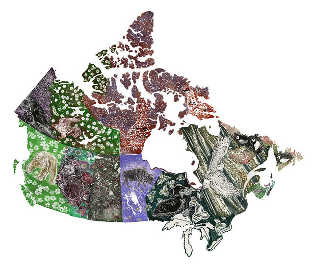
A couple of people asked whether I could print my series of province and territory linocuts on one giant pieace of paper. I was thinking that a book might be a better format. You see, the provinces are not at all printed to scale (and may even have some variations in projection). I made this decision consciously. You see, the smallest province PEI is 5,660 km2 whereas Nunavut, the largest of either province or territory is 2,038,722 km2- that is a bit more than 360 times as large. So, unless I was making art for a very very large space indeed, and could make prints in tens of square metres, I would never be able to acheive enough detail in the smaller provinces. However, it is possible to digitally place all the images side by side, and with a little Photoshop magic, you can see all of Canada. The pieces don't match perfectly; but, between inprecision in my carving, and variations from map to map (of scale, resolutions and maybe even projection) it's a pretty good fit.
No comments:
Post a Comment